


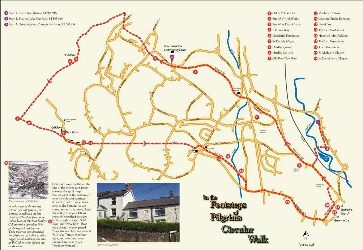


THIS circular walk around Cwmbran and Mynydd Maen is approximately 15km, or nine miles.
This is a circular walk that can start from three different car parks on the loop. All have access to facilities; their locations are marked on the plan as 1), 2), and 3).
Parts of the walk cross open mountainside, steep slopes or rocky areas so please ensure you have adequate clothing and good walking shoes or boots. Care must be taken when crossing busy roads.
If you are starting at the Llanyrafon Manor (1) or the adjacent Boating Lake (2) car parks, walk towards the lake, crossing the footbridge over the Afon Llwyd. Skirt right, around the pond and head for the footbridge over the railway line. Once over the bridge, follow the path as it takes you up onto the Llantarnam Road. Cross the road and turn right.

The walk map
1) Walk along Llantarnam Road, passing Oakfield Gardens. Bear left where the original route of Llantarnam Road turns away from the new road to the new town centre; cross over Henllys Way and walk along Victoria Street as it turns you into Old Cwmbran.
2) After you pass the clock and the council offices in the town centre, turn left along Commercial Street. At the end of Commercial Street, cross over onto St Dial’s Road, passing St Gabriel’s Church on your right and climb up the hill.
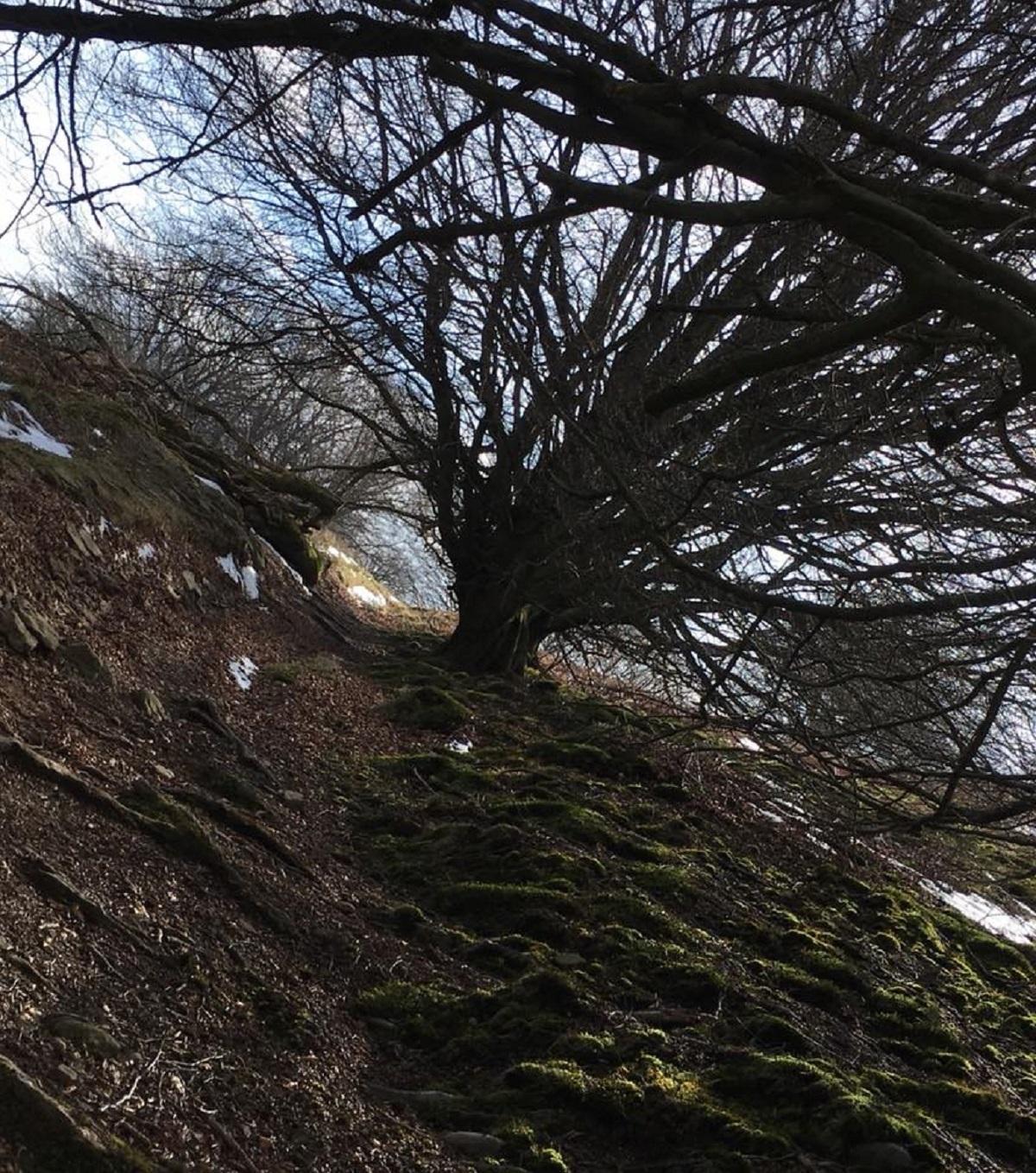
3) As the lane comes onto the roundabout, cross straight over to Ty Gwyn Way.
4) The footpath that goes up the bank alongside Ty Gwyn Way continues to follow the line of the old St Dial’s road as it goes through a tunnel of trees and then bears to the left of Diwedd Lon (Lane End House); take the sunken lane, or ‘Hollow Way’, that goes between the surfaced estate path on your left and the garden wall of Diwedd Lon. As you get to the end of the sunken lane, climb up the bank and turn left to use the ‘banana’ footbridge to safely cross Ty Gwyn Way, take the second right-hand path that runs beside the fence, then after about 50 meters, turn left. As you climb through the Thornhill Estate the footway crosses the Hafren Road for the first time. Carry on up the path as it crosses over the Hafren Road for a second time, goes through a barrier and then climbs steeply up the side of Mynydd Maen (Stone Mountain), crossing over a lane known as Graig Road. Take a sharp left along a green lane lined by old beech hedges and pudding stone markers. Continue along the track until you reach a gate that leads onto the common of Mynydd Maen. Go over the gate and bear left through the bracken or ‘fern’ , go over the stile and follow the path as it drops down to Llanderfel Farm.

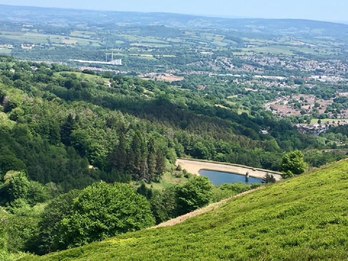
Picture taken from Mynydd Maen, looking toward the Blaen Bran Reservoir. Picture: Marie Coombes
5) Once through the field gate (or over the built-in steps) go to the right of the old Monmouthshire longhouse and over another stile. The path begins to climb gently along the lower slopes of Mynydd Henllys, running along another sunken or hollow way.
6) The route passes the site of Llanderfel Chapel, which is in an enclosure to your right. Continue on the path, climbing over another stile; the route begins to open out and signs of an industrial past become evident on your right in the form of soil heaps and quarries. Where the track appears to fork, take the right track as the route gently climbs the side of Mynydd Maen.

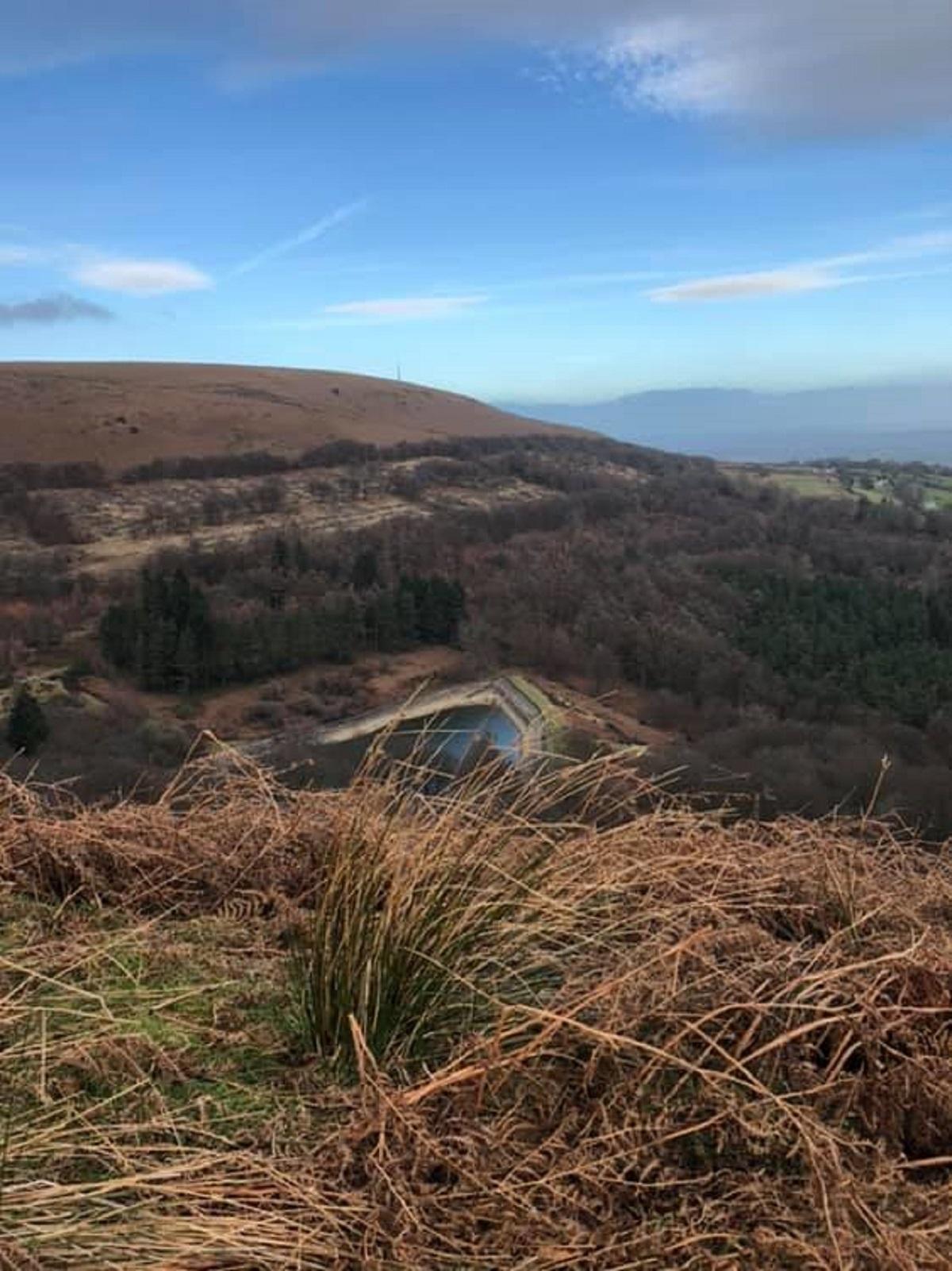
A view from Mynydd Maen. Picture: Marie Coombes
7) As you draw level with the second and largest stone quarry on the right, look for a stile and a steep green path going down the hill on your left. This is the top of a 3.2km (two mile) long incline that drops 201 metres (600 feet) to the valley floor. Go over the stile and follow the path as it passes the site of Henllys Colliery.
8) Continue down the hill on the line of the incline as it passes between the soil heaps, bearing right at the bottom; go over the stile and continue down the track to some stone steps at the bottom.
MORE NEWS:
- Oakdale 'Louis Vuitton' drug dealer ordered to hand over cash
- Transport projects across Gwent delayed due to coronavirus
- How to take part as Newport Walk for Dementia returns in April
9) Bear right down the lane, past ‘Four Houses’, bear left around Belle Vue Terrace then bear right, and continue down Incline Lane as it passes ‘Machine Cottage’.
10) Part of this building once housed the tram weighing machine, hence the cottages’ unusual name. This was the end of the second drop and start of the third and longest section of the incline.
11) You leave this 2km section of the incline at Coed Eva, opposite the old Mill Tavern. Turn left and then turn right at the end of the road, cross over the road at the roundabout, taking the track opposite that leads you past the old Glan y Nant Farmhouse and onto Garth Lane. The incline ended near the Mill Tavern.
12) As you come to some restored limekilns, turn and look back towards Mynydd Henllys and the site of Llanderfel Farm and Chapel. Continue along Garth Lane to the canal at Ty Coch.
13) Once over the bridge, turn right; at the end of this stretch of tow path turn left along Ty Coch Lane.
14) As you pass in front of Ty Coch Terrace, look for a round black plaque dedicated to John Williams (Fielding) V.C. Bear left then turn right onto Ty Coch Way; at the end if the road turn left and walk along Hollybush Way. Take care crossing by the roundabout as this is a very busy road. Continue straight ahead through Llantarnam Park Industrial Estate.

The top of Mynydd Maen. Picture: Joss Edwards
15) At the end of Llantarnam Park Way, turn left by the Abbeyfields roundabout, walking up the hill until you are opposite the Greenhouse Public House.
16) If you have time, cross over and take a closer look at the plaque above the entrance door. It shows two tail-coated, clay pipe smoking gentlemen sat at a fine gate-legged table. The translated text reads: The Greenhouse 1719. Good beer and cider for you. Come inside and you shall have some”.

Picture taken from the top of Mynydd Maen. Picture: Kate Edwards
17) In the graveyard of St Michael’s Church alongside the inn you can see the white gravestone of John Fielding. Opposite the church is a cottage that has had many uses over the years, one being a blacksmith’s forge. The metal disc used to place iron tyres onto wagon wheels can still be seen in the front garden.
18) From the pub, cross over the road and walk through the new housing estate, John Fielding Gardens, looking out for the slate memorial to the VC hero at the end of the cul-de-sac. Turn right and then left down the path that runs between house numbers 13 and 14 into the school playing fields. Cut diagonally right across the fields to a path that takes you to the right of the buildings then turns right between the houses and onto the Llantarnam Road. Turn left and walk on until you are opposite the path that takes you back over the railway bridge signed to the boating lakes.

Mynydd Maen. Picture: Marie Coombes
If you started at Greenmeadow Community Farm, go to the start of the route description and continue until you reach 3) on the map.
Thank you to Torfaen County Borough Council for allowing us to reproduce this walk. For more go to https://tinyurl.com/ys7nvbr6


Comments: Our rules
We want our comments to be a lively and valuable part of our community - a place where readers can debate and engage with the most important local issues. The ability to comment on our stories is a privilege, not a right, however, and that privilege may be withdrawn if it is abused or misused.
Please report any comments that break our rules.
Read the rules hereLast Updated:
Report this comment Cancel