


NOW that we can get out and enjoy the countryside, we are featuring walks from further afield.
Today we feature a walk which takes in some of North Gwent's industrial heritage.
The Crawshay Bailey Trail

This is a moderate walk of 5.5 miles (9Km) and should take about two hours.
- Start at the Market Hall Car Park, Brynmawr.
- Leave the car park by the narrow exit into the Market Square. Once in the square Baileys Llangattock Tramroad divides into two. The left branch runs almost at right angles down Station Road heading for ‘Limestone Road’ and the ironworks.
")
Market Square, Brynmawr. Picture: Google
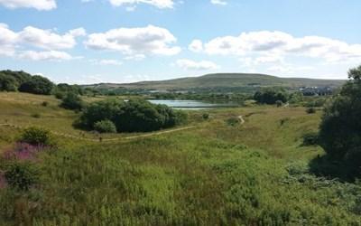
- Follow the route of the other branch straight across the square, cross the B4248 and swing left into Warwick Road. After the 600m you will see the Welfare Park - the site of the Heathcock Pond, one of the Nantyglo Ironworks feeder ponds.
- Immediately after the park turn right onto Park Crescent - the route of the Disgwylfa Tramroad. Follow Park Cescent until you will come to a T-junction. Turn right and follow this road into Well Street. Turn left along Well Street and cross the B4248 (George Street).
- After about 200m, you will ascend some steps onto the A4047 (King Street). Turn right along King Street and after 100m turn left to follow Clydach Street. You are still on the course of the Disgwylfa Tramroad.
- Follow Clydach Street along its winding course for just over one km. As you leave Clydach Street and enter Aneurin Crescent, there are some finger-shaped tips on the left. These are part of the 'patches' – coal and iron-ore workings to the north of Brynmawr.
- At the end of Aneurin Crescent follow, the path ahead of you and cross the gravel road, go over the stile and take the path which follows the hedgerow. This path is the original tramroad with stone sleepers embedded in the earth. The tramroad is visible as a ledge cut into the hillside. It crossed the river Clydach about one km ahead of you near the highest point of the A465 and then turned eastward to the north of the river.
- Follow the tramroad westwards. You are now on 'The Patches' where people dug into the hillside to mine coal and iron ore. On the opposite side of the valley you can still see the tramroads, patch mines, levels and quarries that supplied raw materials to the Nantyglo Ironworks.
- Where the path becomes narrow take a left turn up to the brow of the hill. Walk on until you come to three ponds and the remains of a small mining hamlet known as Rhas Fach or Little Race. From Rhasfach, retrace your steps to Aneurin Crescent.
- Half way along Aneurin Crescent, take the footpath to the left. Follow this until you reach Intermediate Road and turn right. This is Bailey’s 1829 Llangattock Tramroad linking the Llangattock Quarries to Nantyglo.
- Follow Intermediate Road to King Street, cross into Lower Bailey Street and so back to the Market Square.
- From the Market Square turn left into Alma Street – the route of the Clydach Railroad. In 1814, the Nantyglo Ironworks struck a deal with the Beaufort Ironworks to use this route down to Gilwern, but they had to pay a toll on every ton of iron transported.
- Follow Alma Street to the junction with the A4047 (King Street). Follow this to the roundabout and pass under the Heads of the Valleys Road using the subway. In the centre of the roundabout, you will find Clydach Bridge. This carried both the Clydach Railroad and the main coach road from Merthyr to Abergavenny.
- On the other side, turn right along the footpath running parallel with the Heads of the Valleys Road. This is still the route of the Clydach Railroad. After about 300m, you will see a lay-by on the opposite side of the A465. Here you will see the Clydach Coal Levels, opened in 1812 to supply coal for sale in Abergavenny.
- Follow the footpath for a further 300m. Here an original 1793 bridge crosses the Nant Melyn. Continue for a further 350m to cross under the Heads of the Valleys Road. This is the site of Pont Harry Isaac. On the other side, turn left and pick up the footpath. This follows the line of a railroad opened in the mid-1790s to link the Gelli Felen coal pits to Beaufort Ironworks.
- Follow this as it goes slightly uphill. After 350m you will reach the M T & A Railway that follows the course of the Govilon Tramroad of 1821. Turn right onto it and follow the trackbed back to the roundabout at Brynmawr and follow Alma Street back to the Market Square.

Market Square, Brynmawr
This trail is one of seven 'In the Footsteps of the Iron-Makers' series that is part of the Green Mines/Atlanterra project to promote the area's mining heritage through tourism.
For other walks in this area go to www.blaenau-gwent.gov.uk/en/visitors/local-trails/


Comments: Our rules
We want our comments to be a lively and valuable part of our community - a place where readers can debate and engage with the most important local issues. The ability to comment on our stories is a privilege, not a right, however, and that privilege may be withdrawn if it is abused or misused.
Please report any comments that break our rules.
Read the rules hereLast Updated:
Report this comment Cancel