


THIS walk has been carefully devised to incorporate the natural history of the Monmouthshire and Brecon Canal, leading to breathtaking views, woodlands, spectacular mountain scenery and reminders of Caerphilly County Borough’s rich and ancient past.
The walk includes some steep ascents and descents with excellent views across the Bristol Channel and Severn Estuary can be achieved from Twmbarlwm Hill Fort.
- Distance: nine miles
- Approximate Time: six hours
- Difficulty: Strenuous
- Climb: 900 feet / 270 metres
- Start and finish point: Visitor Centre

1. From the main entrance of the visitor centre, go down the steps and turn left past the interpretation panel, and turn right on to the path. Stay on this path until you reach the entrance of the main car park. Directly opposite you will see a wooden chicane. Go through this chicane and you are now on the Ash Path.
2. Continue along the Ash Path, ignoring the kissing gate and continue on to the red dust path down to the main road.
3. Turn left at the main road and continue until you reach Halls Road Terrace (passing the Pontywaun Stones), where you can pick up the canal and head towards Risca, (passed Spiritualist Church).
4. Stay on this path and follow the signs, you will cross over the road at Pontywaun and shall see your first pieces of community art, which celebrates the history of the canal.
5. Continue along the path, past Pontywaun Bridge and take a moment to take a slight detour to look at the memorial dedicated to the lives lost in the Blackvein Colliery disaster. Once you are ready, continue along the path until you reach the second stone bridge (Darren Road Bridge).

Rhys Bennett shared this picture of his sons, Noa and Efan, having a break and admiring the fantastic views while hiking up Twmbarlwm
6. Go past the houses on your left until you reach the main road (Darren Road), cross over and continue along the canal path.
7. Pass under a third stone bridge (Pen-y-Rhiw), continuing past a fourth bridge (Moriah Chapel Bridge), crossing over the road at Gelli Avenue. Continue on crossing over the road at Thistle Way, staying on the path, where you will pass a distance way marker (Newport six miles), until you reach the fifth stone bridge.
8. Go across the bridge and take the wooded path to your right until you reach a metal gate and stile, which leads to an open field. (Dogs must be kept on a lead)
9. Head up the incline towards the pylons, keeping the fence line on your right, going through the gap, and heading towards the seven bar gate between the two pylons.
10. Once through the gate walk uphill, keeping the hedgerow to your right and head for en stile at the top right of the field.

Cwmcarn Forest Drive. Picture: NRW
11. Climb over the stile (not dog friendly), and cross over the road heading for Risca Leisure Centre. At this point you will catch your first views of the Bristol Channel.
12. Stay on the road towards the leisure centre and follow the signs for Upper Grippath Farm (passing the leisure centre on your right). Do not take the left turn to mountainside, continue forward passing the houses on your right.
13. At the T-Junction, turn left uphill and take the track on the right (keeping the house on your left hand side).
14. Stay on this road and take the first right up hill on a narrow stone track (look behind you for great views!) continuing along it as the track levels out. Continue along this path (passing the woodland trust Coed Cadw) on your left, and continuing through the woodland, crossing a small stream, and ignoring any tracks to either side. Stay on this footpath and you will come to a finger post pointing to Risca the way you have just come. Ignore the track to your right and carry straight on.
15. As you continue on you will be able to see your first glimpse of Pant yr Eos Reservoir. You will eventually come across a metal gate and stile which opens up onto farmland. Dogs must be kept on a lead while on this land. This is a good spot to stop for lunch and a cuppa and enjoy the views.

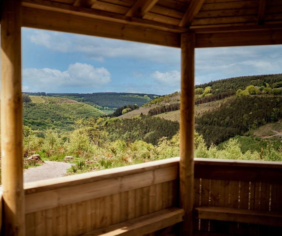
The view from the gazebo out over the valley at Cwmcarn Forest Drive. Picture: Natural Resources Wales
16. Once in the field, continue forward keeping the fence line on your left, until you reach the gate and stile on to the road. Cross onto the road and turn right, you now have a good view of Twmbarlwm and the reservoir.
17. Continue on the road, pass the cattle grid uphill and take the next track to your left. Cross over the forest track (ignoring the barrier to your left) and continue straight on up the hill. Follow the left hand track up the hill keeping the forestry block to your left.
18. Follow the steep climb up, over the stile until you reach the summit of Twmbarlwm (the Iron Age hill fort steeped in folklore and legend). Enjoy the views!
19. Head towards the trig point (which is to the left of where you have just come), staying on the path making your steep descent towards the kissing gate at the bottom of the mound towards the tarmac road. You are now at old car park seven of the Forest Drive.
20. Follow the road as it sweeps around (downhill) to a kissing gate and track on your left. Follow this track down until you reach the tarmac road.
21. Turn right at the road and follow it gently uphill for approx 50 yards until you reach the track on your left (easily visible from the road) and continue until you reach the road again. Turn right then take immediate left (small grass path) off road and continue down this path until the second path on right (downhill). (Do not take the Twrch path, this is the bike track).
22. Continue straight down the path passing two interpretation signs and through the gate.
23. Continue on the tarmac road, following the stream down to the lake. Keep the lake on your left and follow the little footpath between the stream and campsite back down to the centre!
- For more walks at Cwmcarn go to www.cwmcarnforest.co.uk/activities/walking-at-cwmcarn/


Comments: Our rules
We want our comments to be a lively and valuable part of our community - a place where readers can debate and engage with the most important local issues. The ability to comment on our stories is a privilege, not a right, however, and that privilege may be withdrawn if it is abused or misused.
Please report any comments that break our rules.
Read the rules here