


THIS walk follows a path above limestone cliffs where peregrines nest, to the lost medieval village of Lancaut and the ruins of St James’ church.
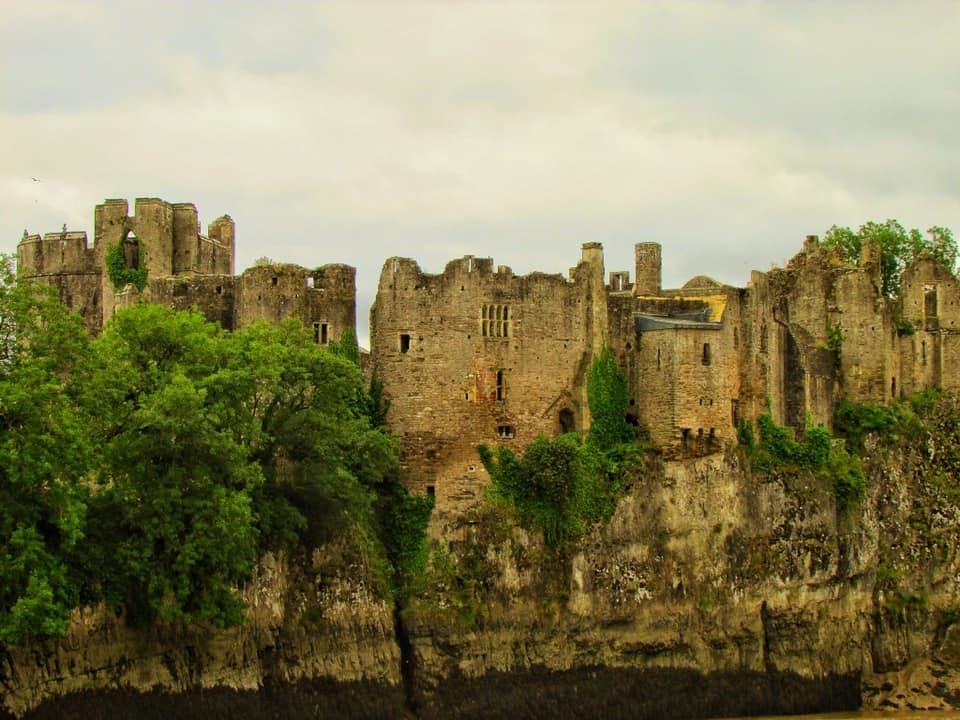
Start at Chepstow Castle
Length: approx six miles. Moderate climbs and descents.

Shorter walk starts at Lancaut Lane carpark by the falcon sculpture (point six on the map).
Turn left out of Chepstow Castle car park and walk down to and over the old bridge spanning the Wye (two).
Halfway across the bridge is the border between Wales and England. The border has moved over the centuries and Lancaut and the Forest of Dean were part of the Welsh kingdom of Ergyng in the early medieval period.
At the end of the bridge cross the road to join The Gloucestershire Way. Continue up this walled lane until you reach the road.
Cross the road and follow the Offa’s Dyke Path along the lane and then turn left through a kissing gate into a field signposted Offa’s Dyke Path. Walking uphill, head towards the top right hand corner of the field.
You pass a ruined lookout tower or windmill (three) on your right, thought to have been converted into a folly in the early 19th century.
In the far corner of the field is a metal kissing gate, which you go through keeping the stone wall to your left for about 150m. Where the wall meets a higher wall is another kissing gate.
Go through, between a fence and a walled garden on your right. At the driveway turn sharp right along the wall and very soon left through a kissing gate.
Follow the grassy path straight across the fields towards the kissing gate opposite (four).
To your right is a large Victorian mansion called ‘Pen Moel’, which was rebuilt in the 1890s.
Turn right at the kissing gate and continue to the road. Turn left to cross the road and walk uphill for a short distance.
Cross the road again at the ‘Offa’s Dyke’ sign (on the left) and follow Offa’s Dyke Path uphill. Keep following Offa’s Dyke Path signs at the junction, from where there are good views of the Severn Bridge.
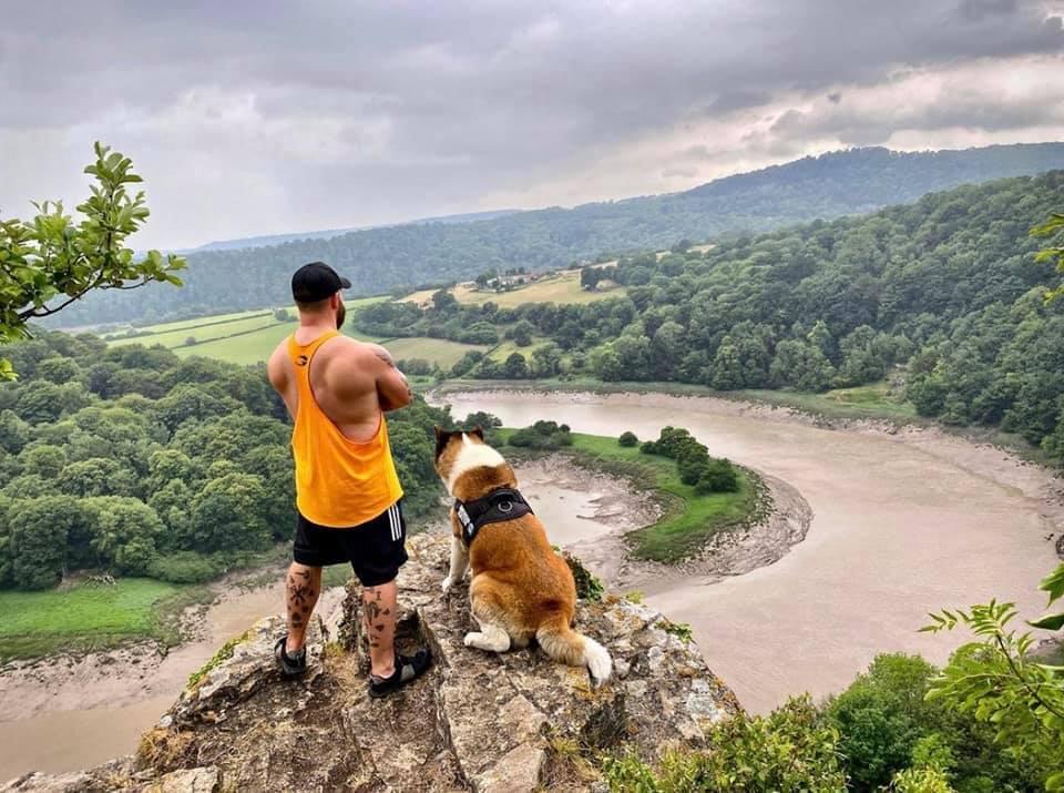
The path now runs along the top of quarried cliffs (five) and after a short distance the view opens out so that on a clear day you can see your destination - Lancaut Church. The cliffs below held valuable resources of limestone and have been extensively quarried.
Peregrines nest here and the area is a Site of Special Scientific Interest managed by Gloucestershire Wildlife Trust. The cliffs are also popular with climbers.
Keep straight on under the footbridge and through a kissing gate. At the road turn left and cross the road, walking along the roadside for a short distance.
To avoid the road keep on the grass path and cut the corner off at Fox Hollies. Turn left at the ‘Lancaut ¾’ sign and continue along this road, passing ‘Spital Meend’ on your right and soon after the peregrine sculpture and car park on the left (six).
Walk downhill, ignoring sign for Laucaut church on left, passing Ban y gor Nature Reserve (seven) on the right, where a Roman oil lamp from North Africa, dating from the 5th century was found.
Cross the cattle grid and at the junction (eight) turn sharp left through the first gate into the field. Walk downhill diagonally to the right of the veteran oak tree where you can enjoy the lovely views of the cliffs surrounding the isolated Lancaut Peninsular.
Continue in the same direction downhill to the far right hand corner of the field.
There are some levelled patches and bumps in this field which are probably the remains of the lost medieval village of Lancaut.
Go through the small wooden gate downhill to visit the ruined 12th century church (nine).
Leave the churchyard and walk down to the river passing the ruins of ‘Fish House Cottage’ on the left below the churchyard wall. Go through the gate and continue beside the river and up some steps. This ‘mound’ may have been used to load trows with quarried stone and remains of the quarrying industry litter this area.
You can continue along the path to a bench (10) where you can sit and enjoy the views stretching down the Wye towards Chepstow.
Fallen scree now makes the old fisherman’s path back to Chepstow dangerous, so retrace you route back to the church (nine).
As you follow the path uphill from the church look to the left to spot several flat terraced areas one above the other (11). These levelled platforms are the remains of building plots and in a few places the line of a wall can be seen. This is the deserted medieval village of Lancaut, a place where people lived, farmed, fished and worshipped.
Continue uphill through a kissing gate and keep climbing.
At a T-junction turn right passing old lime kilns and, just after them on the left, evidence of where the lime burnt in the kilns was quarried. Continue up to a road and turn right to reach (12).
Stop at the metal gate on the left and look to the left to see the earth banks and ramparts of an Iron Age promontory hillfort.
Continue back to the carpark where the short walk ends.
Alternatively retrace your route back to Chepstow. Don’t miss a last look at the view from Wintour’s Leap (13).
Legend has it that during the Civil War the Royalist Sir John Wintour escaped capture by the Parliamentarians by leaping down these precipitous cliffs and crossing the Wye.
For more walks in and around Monmouthshire go to www.visitmonmouthshire.com/things-to-do/short-walks-in-monmouthshire.aspx#.


Comments: Our rules
We want our comments to be a lively and valuable part of our community - a place where readers can debate and engage with the most important local issues. The ability to comment on our stories is a privilege, not a right, however, and that privilege may be withdrawn if it is abused or misused.
Please report any comments that break our rules.
Read the rules here