

HERE'S a collection of photographs from our archive showing a bird's-eye-view of the city in the 1970's, 80's and 90's.
They show how much Newport has changed over the years - from the sprawling St Joseph's High School in Duffryn to the river wharfs and dockland area. Do you remember Newport looking like this?

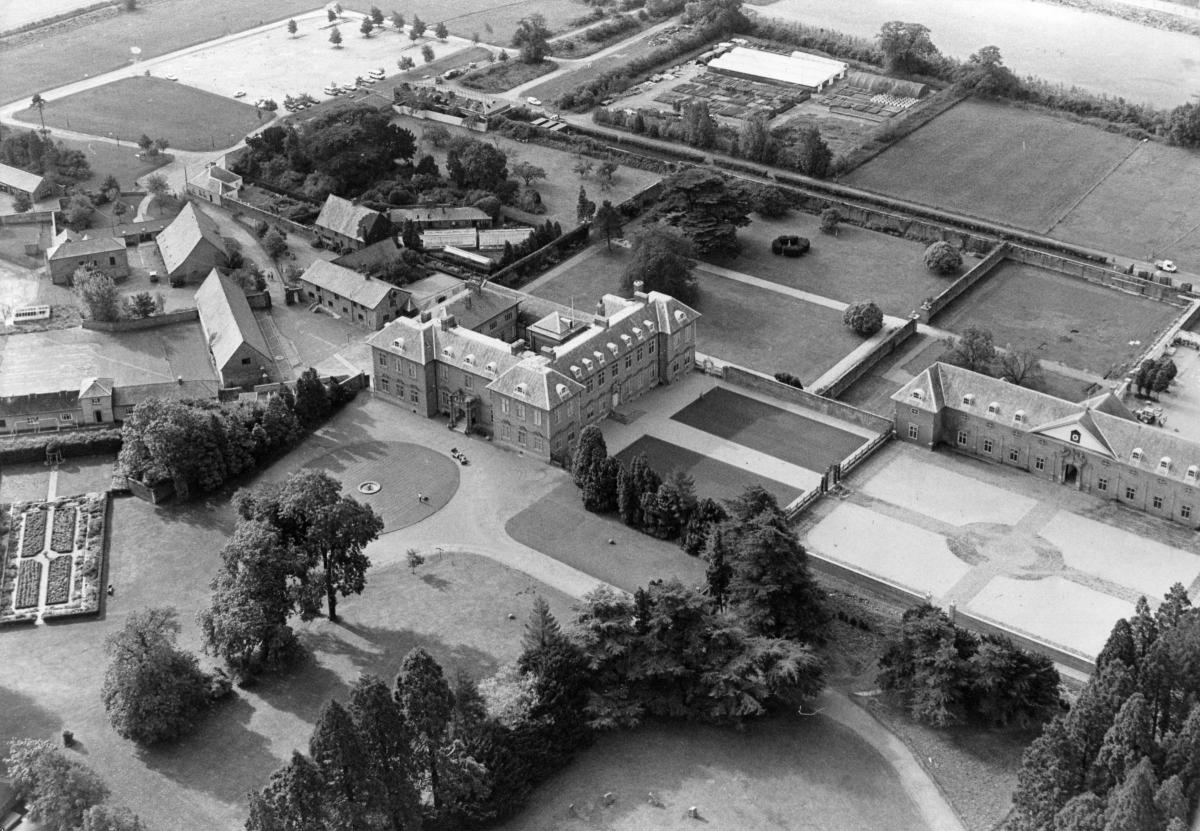
This is Tredegar House in 1989 when the historic mansion was under the care of Newport council and it was yet to be developed into a visitor attraction. To the right of the house are the stables, to the left cottages and barns. There is no sign of the car park, playing area and coffee shop there today.

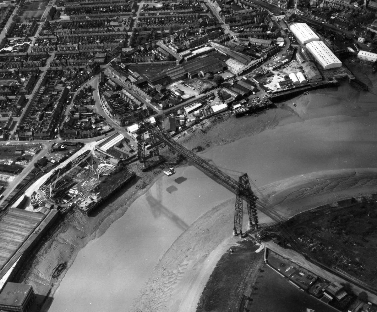
This is the River Usk in 1970 above Newport's Transporter Bridge. This is a fascinating photograph showing all of Pill's housing prior the great clearance project in the 1970s where entire streets, deignated as slum housing, were demolished. On the far right there are two white buildings - this is Handiland running next to Church Street and Commercial Road, with Dowd's offices behind. Running alongside the river is Mill Parade with various engeneering works serving the dry dock. The next road along, to the left of Commercial Road, is Courtybella Terrace and beyond is a vast grid system of houses that included Baldwin Street, Jeddo Street, Lime Street, Robert Street and Arthur Street.

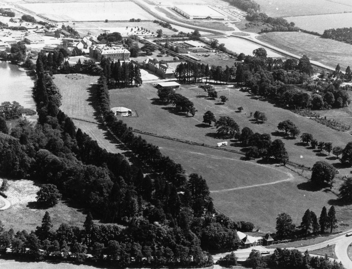
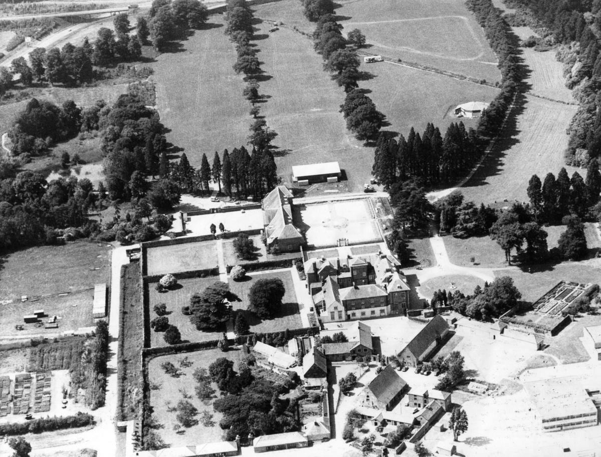
Another fascinating view of the Tredegar House estate, this time taken in 1980. Note two lines of trees running from the house into the fields beyond - said to line an old road from the house to London. In this photograph there are acres of undeveloped land and no housing, supermarket, schools or the caravan site.

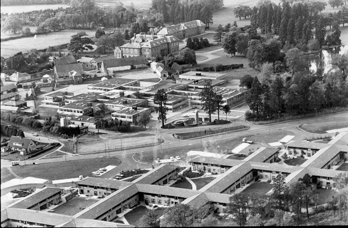
Fast forward to 1982 and we have St Joseph's RC High School in Duffryn and Nightingale Court in front. The school had a large monument in front surrounded by trees, a chapel and overlooked Tredegar House lake.

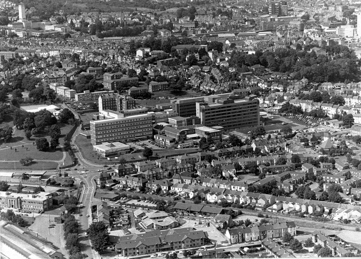
This is the Royal Gwent Hospital in 1992, looking from Mendalgief Road toward Belle Vue Lane. To the left on the picture is White Heads factory, in the centre Cardiff Road and Pill and to the far left is the Friars building, nurses accomodation and even the Civic Centre is just visible.

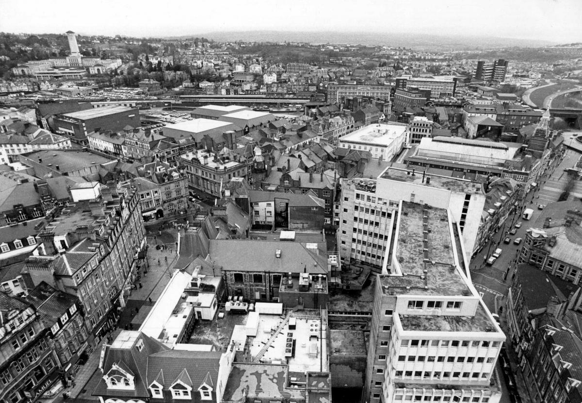
Here's a great image of the city centre from above. Commercial Street with H Sammuel to the left, Bridge Street further up, the former Passport Office right, the BT building in the far right-hand corner and the spire for Newport Market.


Comments: Our rules
We want our comments to be a lively and valuable part of our community - a place where readers can debate and engage with the most important local issues. The ability to comment on our stories is a privilege, not a right, however, and that privilege may be withdrawn if it is abused or misused.
Please report any comments that break our rules.
Read the rules here