

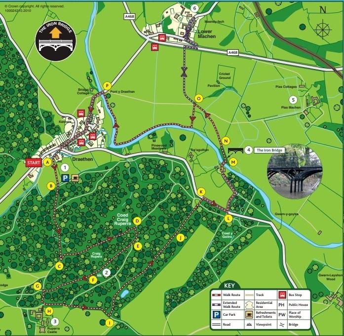
THIS is a 4.5km circular heritage trail which follows the footsteps of the Morgan family, who were connected to this area from the 17th Century. The route passes through Coed Craig Ruperra, a 150-acre woodland, which once formed part of the large Ruperra Estate and is now managed by Ruperra Conservation Trust.

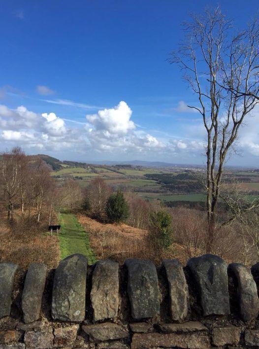
Coed Ruperra, towards the Rhymney valley. Picture: Matthew Broome
The route follows permissive paths and public footpaths, passing important features associated with the rich archaeological heritage of the area. The paths can become quite muddy during bad weather so suitable footwear is strongly recommended. The trail is signed with the distinctive Iron Bridge Waymarking Disc and should take around 2.5 hours to complete.
Descriptions may alter as improvements are made to footpath structures along these routes.

A. Start at the Hollybush Inn, cross the stile at the rear of the pub and follow the trail uphill towards the woodland.
B. Pass through the kissing gate and continue uphill and through the woodland. This path can be very wet during winter season.
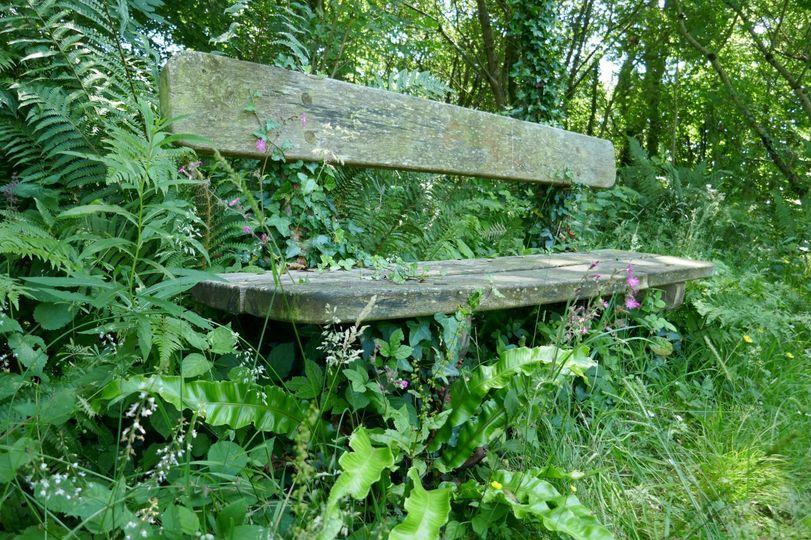
C. At the path junction turn left and follow the waymarker through the woodland. Continue along wooded track heading slightly downhill reaching a bench at the next junction.
MORE NEWS:
- Newport cocaine dealing couple who made £40k back in court
- Rich list Wales: Newport's Terry Matthews third richest man
- New Inn pupil sets up club to support military children
D. At the path junction follow the waymarker to the right and continue along path uphill to a wooden kissing gate.
E. Pass through the kissing gate and follow the waymarker disc towards Craig Ruperra. Enjoy spectacular panoramic views from Ruperra Summerhouse.
F. Continue along the trail and follow the waymarker heading downhill, passing the wooden arbour on your right.
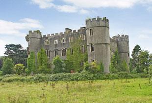
G. At the path junction, turn left and follow the path towards a flight of steps onto the main track behind Ruperra Castle.

Ruperra Castle
H. Turn left and follow the access track adjacent to the castle wall for approximately 300 metres.
I. Turn left through the metal kissing gate and follow the path through the woodland, looking out for the Iron Bridge circular walk waymarker disc.

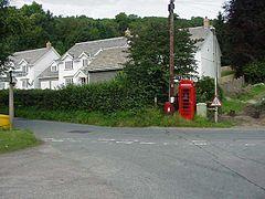
Draethen village crossroads
J. Continue straight ahead following the track passing through 2 metal kissing gates to the lower car park and to the road.
K. Turn right and follow the road for 150 metres approximately to a finger post at Iron Bridge cottage.
L. Continue along the access lane to Iron Bridge cottage, pass Iron Bridge cottage on your right and follow the path to the Iron Bridge.

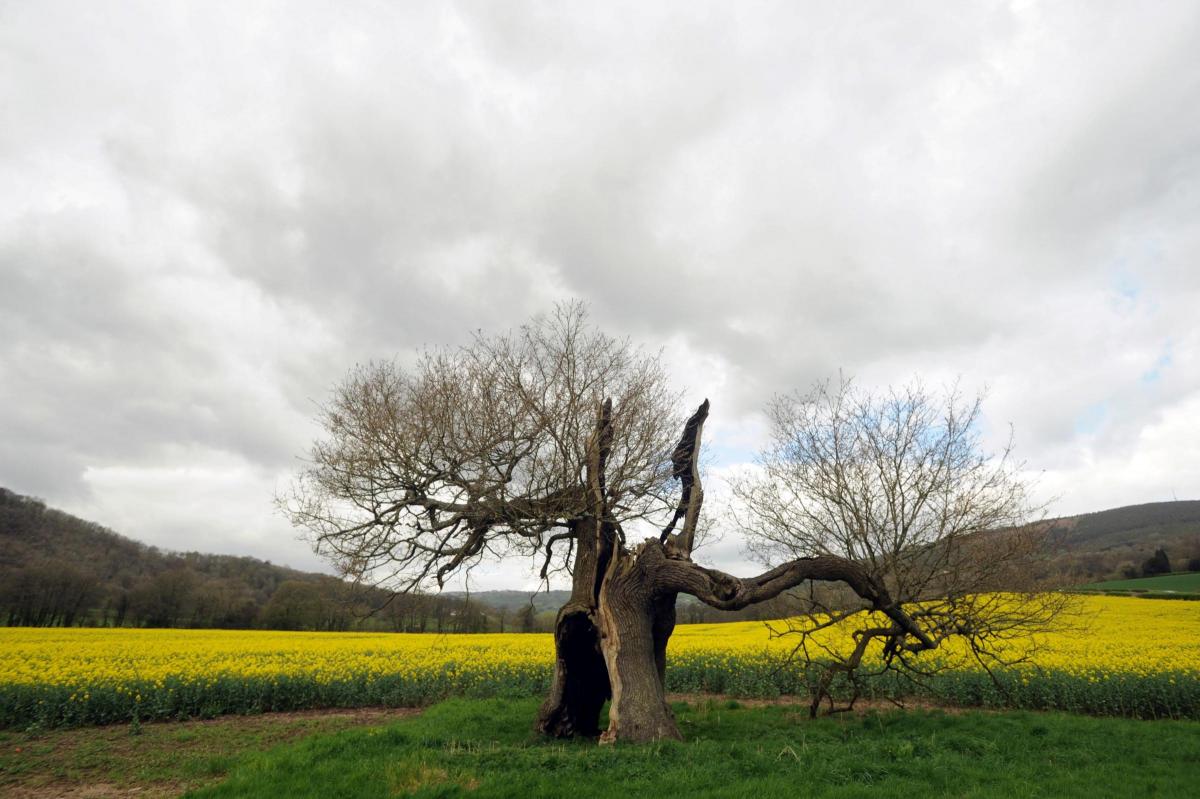
Old tree in a field of Rape Seed, Draethen.
M. After the bridge follow the path through woodland to a metal gate.
N. Follow waymarker arrow across open fields to another kissing gate at point.
O. Here you have a choice, you can either: continue along the well defined track towards Lower Machen by following the waymarker discs showing the extended route (take care when crossing busy road) or turn left along the hedgerow and then follow the river back to Draethen road.

Coed Ruperra. Picture: Ian Agland
P. At Draethen Road follow the waymarker disc over the road bridge to Draethen and the Hollybush Inn.
This walk is featured on the Newport City Council website. For more details and to download the leaflet go to www.newport.gov.uk/documents/Leisure-and-Tourism/Countryside/Iron-Bridge-Circular-Walk-Leaflet.pdf


Comments: Our rules
We want our comments to be a lively and valuable part of our community - a place where readers can debate and engage with the most important local issues. The ability to comment on our stories is a privilege, not a right, however, and that privilege may be withdrawn if it is abused or misused.
Please report any comments that break our rules.
Read the rules here